Belgrade Master Plan to 2021 like you never seen it
| 20 November 2007 - Comments (0) | Reflections |
 We take another look at the limitless and truly amazing possibilities offered by Google Earth. We showed before, how to use Google Earth together with the Master Plan and detailled regulation plans to create very informative layers. This article continue the exploration of the Master Plan as an overlay to show more possibilities of learning about the development of Belgrade.
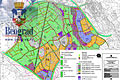
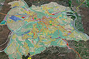
This first view shows the complete Belgrade Master Plan to 2021 in situation in Google Earth. Once in place in Google Earth, it is possible to apply perspective, denivellation and to see it in all directions.
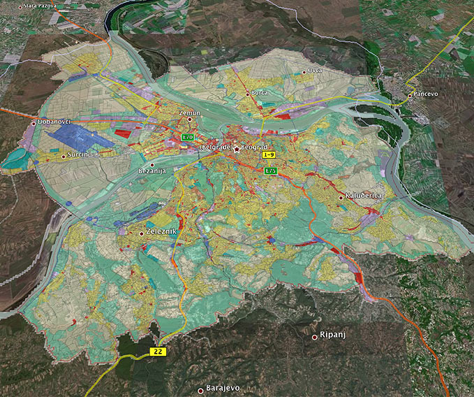
The complete Belgrade Master Plan to 2021 in situation in Google Earth. Legend: yellow: residential area, red: commercial zones and city centers, purple: industrial zones, dark blue: traffic and transportation, dark greenish blue: sport and sport objects, green: green zone, orange: public services and objects, light yellow: agricultural lands (overlay by Lionel Mestre).
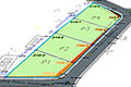
The second view shows the section B, Dobanovci–Bubanj Potok, of the planned Belgrade bypass, connecting E70 with the southbound Belgrade-Niš highway (E75).
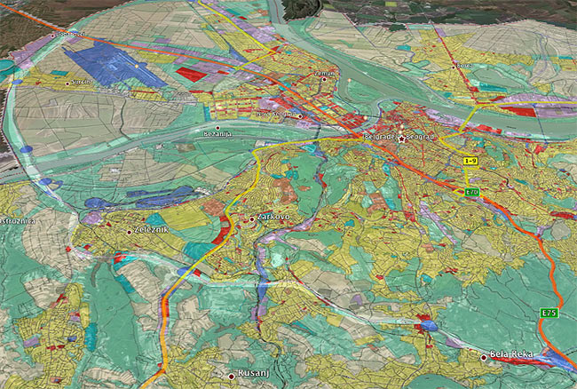
Section B, Dobanovci–Bubanj Potok, of the planned Belgrade bypass. The highlight has been added for emphasis (overlay by Lionel Mestre).
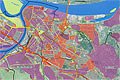
Below is a view of New-Belgrade. As you can see, most of the development of this part of New-Belgrade is already done. It will continue further west along the highway for industry and north-west, south-west for residential buildings. Eventually, two new bridges should offload the over busy Gazela bridge.
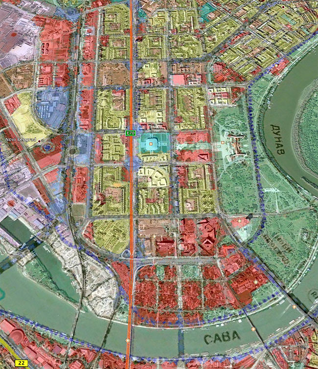
View of New-Belgrade. Note the orientation is West (top)-East (bottom) (overlay by Lionel Mestre).
Last view is for the area where we live and work. It shows Padina, Braće Jerković, Veliki Mokri Lug, Kumodraž and the still unspoiled Kumodraž Field (Kumodraško Polje) area. From the master plan, we can see that a big part of Kumodraž Field will remain untouched for some time, as it is classified as agricultural land. Beyond 2021, it is hard to know what will happen of this area.
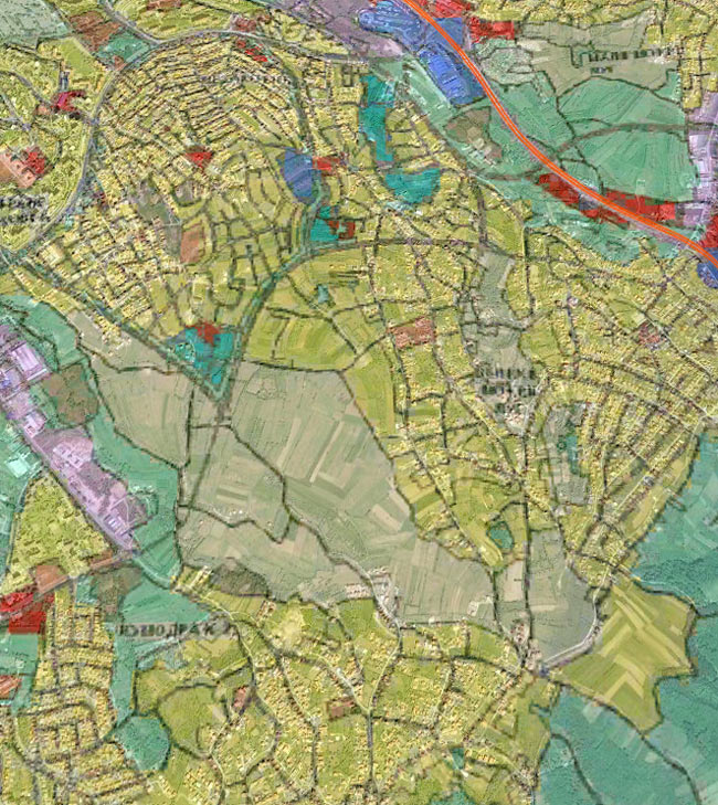
South-east part of Belgrade with Padina, Braće Jerković, Veliki Mokri Lug, Kumodraž and Kumodraž Field (overlay by Lionel Mestre).
There are numerous possibilities to gain information using Google Earth and other public geographical data. It is a fascinating domain we will continue to explore.