Essential online tools to explore Belgrade's detailed regulation plans
| 07 February 2010 - Comments (0) | Procedures |
 We updated this article to follow the development of the online tools offered be the Land Development Public Agency (Beoland) and the Institute of Urbanism (Urbel). The two institutions give access to web based, interactive maps to explore available detailed regulation plans. These 2 essential tools are incredibly useful in giving the right information on a given plot of land.
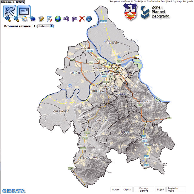
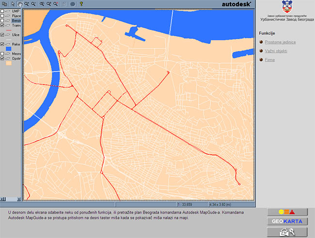
Online map of detailed regulation plans - gisapl.beoland.com/direkcijaSpoljni/
This interactive map provides all new detailed regulation plans that are in a digital form (done after 2003). This is certainly the first time that all of those plans are made publicly available in a digital form.
Beoland recently made a big update to this online tool. The access URL changed and the interface has been completely renewed. The map now displays full screen. A bit of adaptation is needed on the first contact but the same information as before is still available. The areas covered by urban plans made before 2003 are now also displayed on the map. But because those plans are not digital, they still cannot be downloaded.
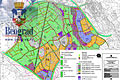
Belgrade detailed regulation plans webpage from the Belgrade Land Development Public Agency.
There is the possibility to show or not to show several layers including the aerial pictures of Belgrade and the different plans. Visualizing the situation with aerial pictures is a great bonus, but the pictures are older than what you can find in Google Earth/Google Maps which has just been updated for Belgrade.
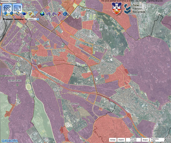
Zones covered with new detailed regulation plans are shown in red, while zones covered with older urban plans (before 2003) are shown in purple.
Directly from the map, you can download in PDF any of the new detailed regulation plan in order to get all key construction parameters on a land (number of floors allowed, construction index, etc...). There is no need to go to the Secretariat for Urban Planning and Construction.
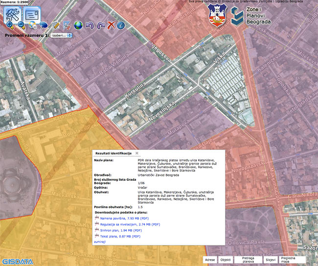
For each new detailed regulation plan, it is possible to download in PDF format, the complete plan and the text of the regulation.
For older detailed urban plans, before 2003, you still need to go to the secretariat.
Information displayed on one urban plan, done before 2003, not accessible as PDF.
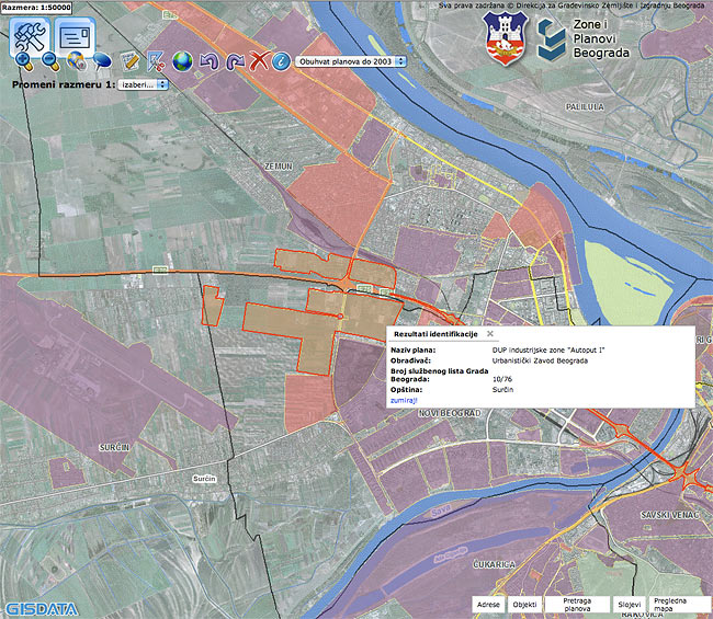
Interactive map of all detailed regulation plans - mapa.urbel.com/beoinfo/
The Belgrade Institute of Urbanism provides an interactive map that shows the covering of Belgrade area by all detailed plans (older detailed urban plans and newer detailed regulation plans). Those older plans are not in a digital form and cannot be made available online easily.
This tool was complementary to the one above because Beoland displayed only new plans (after 2003). Now that Beoland also displays plan before 2003, the 2 tools overlap.
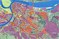
Coverage of Belgrade by detailed regulation plans and detailed urban plans from the Belgrade Institute of Urbanism.
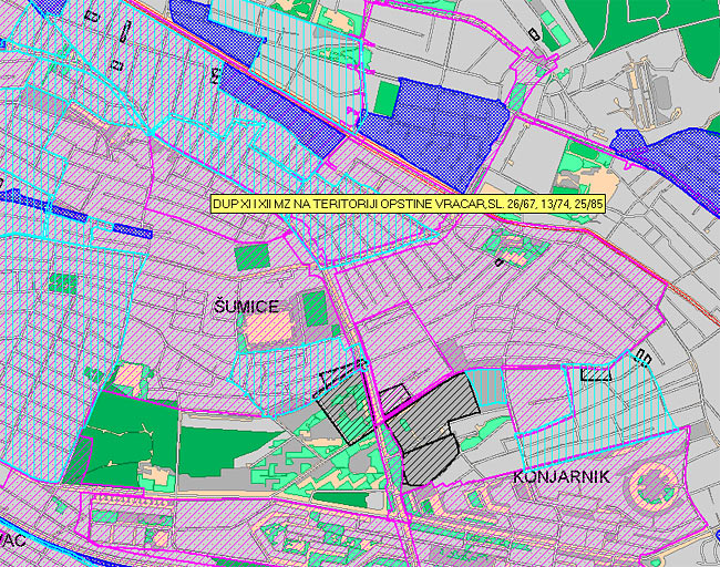
Zoom on Sumice area. It is possible to zoom up to street level. In light blue are the new detailed regulation plans (those you can get fully from Beoland), in dark blue and pink are the older urban plan (called DUP as shown on the screenshot above). The zones not covered by any color are not covered by any detailed plan.
Given a location, you can immediately see if it is covered by a detailed plan or not, and if so, by which detailed plan. You cannot get more information than that from this interactive map. If your location is covered by a light blue zone (new detailed regulation plans), a simple visit to the first tool we presented will give you everything you need. Else, you still have to go to the Secretariat for Urban Planning and Construction and ask.